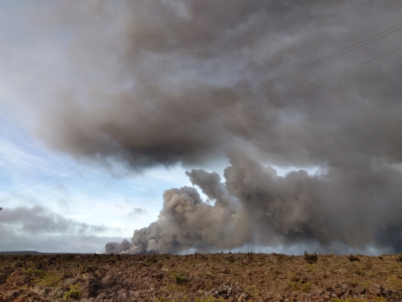
When extreme and dangerous air pollution events strike and blanket the air with hazardous levels of pollution, it causes a major threat to public health and safety. It’s also exceedingly challenging to monitor. The pollutants move quickly through the atmosphere, and can undergo chemical transformations from one form to another, leaving it difficult to predict the level of human exposure.
In the United States, the primary sources of outdoor air-quality data are from ground-based, government-regulated air-quality monitoring systems that measure pollutants such as ozone and particulate matter. Due to the high cost of these high-performing systems, the number of monitors measuring air quality across a geographic area is relatively sparse. As a result, these systems are not well-suited for monitoring extreme air-quality events, in which pollutant levels can be exceedingly high and variable over relatively short distances.
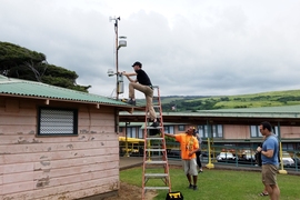
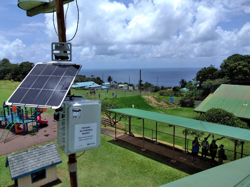
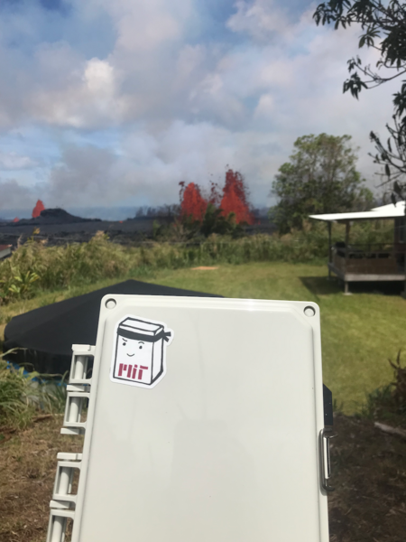
In a new study, researchers in MIT’s Department of Civil and Environmental Engineering (CEE) demonstrate an alternate approach for monitoring extreme air-quality events with the use of low-cost sensor (LCS) networks. The work was carried out in mid-2018 on the Island of Hawaii, when the eruption of the Kilauea volcano filled the air with toxic sulfurous gases and particles (“volcanic smog” or “vog”). In response, the researchers developed and deployed a network of 40 low-cost sensors around the island to monitor the vog in real-time, which provided much higher resolution of localized levels of air pollution than existing air-quality measurements.
The paper, published in PNAS (Proceedings of the National Academy of Sciences), demonstrates the power of LCS networks in their ability to map pollution exposure and chemical transformation of air pollutants for air-quality research, public health monitoring, and emergency response.
“There is a real demand for this kind of data and information about the air people are breathing,” says lead author Ben Crawford, assistant professor in the Department of Geography and Environmental Sciences at the University of Colorado at Denver, who deployed the sensors in Hawaii while a postdoc at MIT. “We need these low-cost sensors and the regulatory air monitoring systems to give us a better understanding of what's happening in the air we are breathing.”
Built for remote air quality sensing
The custom MIT sensors provided real-time levels of two toxic components of vog: sulfur dioxide gas (SO2) and airborne particles, also known as particulate matter. The sensors are also solar powered, so they were deployed in remote areas of the island and communicated wirelessly over the cellular network. Because of the small size and low cost of the sensors, the researchers were able to place the sensors at different distances downwind of the volcano, to estimate the full distribution of pollution levels that people were exposed to in all areas around the island.
“The data showed a wide range of pollutant exposure,” says co-author Jesse Kroll, professor in MIT’s departments of Civil and Environmental Engineering and Chemical Engineering. “Some residents were exposed to clean air the entire time, while people living in different points downwind of the volcano were exposed to different mixes of pollutants. This in itself isn’t surprising, but with the large number of sensors deployed we were able to quantify these exposures with much higher resolution than is normally possible.”
Capturing the pollutant exposure in the atmosphere around the island allowed the researchers to witness how the plume was chemically changing with time. “By having sensors at different distances downwind of the event we were able to estimate the rate at which one pollutant, sulfur dioxide, reacts in the atmosphere and converts into a different one, particulate matter,” adds Kroll.
Prototypes of the sensors were originally developed as part of the CEE subject 1.091 (Traveling Research Environmental Experiences, or TREX), an annual undergraduate fieldwork project that takes students to Hawaii to conduct research over Independent Activities Period in January. Over the years, the students discovered limitations of LCS, especially their low accuracy relative to more expensive monitors. Prior to deployment, the researchers co-located all sensors with state monitoring stations run by the Hawaii Department of Health, providing an accurate calibration that was used throughout the entire eruption.
Tracking smog and wildfires
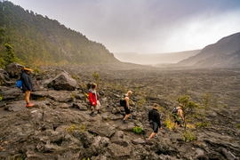
Hawaii’s pristine environment, with its small number of pollutants, simple chemistry, and straightforward meteorology, was the ideal test environment to establish the viability of this approach. But this general approach could also be used for measuring urban smog and wildfires, according to the researchers. The low-cost, compact, solar-powered design of the sensors allows for the technology to be deployed in a number of configurations, allowing it to be linked to other air-quality data sources and technologies.
People can use the information from sensors, together with other data sources, to make informed decisions about the health and safety of communities. It also provides an entryway into educating and bringing peace of mind to communities that live with the dangers and harmful effects from reoccurring extreme air-quality events.
“One of the most exciting parts of this research project was using the sensors for both science and community engagement,” says Crawford. “Since we placed sensors at schools, we went into classrooms and talked about air quality and the ‘vog,’ and we had little demo sensors. It was a really fun way to engage with students about a global environmental issue that was relevant to them because they have lived through this eruption.”
Besides schools, the researchers also placed the MIT sensors at health clinics and some private residences. To provide public knowledge of Kilauea’s vog, the data were shared on a local website created by the researchers that continues to measure air quality on the island today. “These types of sensors provide a real opportunity for people and communities to engage in their own air-quality monitoring that's independent of government monitoring systems,” adds Crawford.
Poor air quality is one of the largest environmental risk factors for premature mortality, heightened by extreme air-quality events that are becoming annual events in parts of the world. LCS networks provide a way forward for other communities to monitor air quality, especially resource-limited regions where air-quality monitoring systems are even more sparse or nonexistent.
“It's crucial from a public health perspective to improve our air quality worldwide. A key step in doing that is identifying the sources of the pollution, as well as the exact mix of pollutants that people are exposed to. Networks of low-cost sensors are great tools for providing such data,” says Kroll.
Additional co-authors of the study include David Hagan, PhD ’20; Professor Colette Heald of MIT’s departments of Civil and Environmental Engineering and Earth, Atmospheric and Planetary Sciences; and collaborators from The Kohala Center, an independent, community-based center for research, conservation, and education.
The research study was funded by the U.S. Environmental Protection Agency (EPA), MIT’s Department of Civil and Environmental Engineering, and the Tata Center.