For many people, the Inca city of Machu Picchu in the Andes of Peru is one of the most recognizable icons of archaeological and adventure tourism in the world. However, for the Peruvian people and for the international scientific community, Machu Picchu is much more than a tourist destination. In addition to being a United Nations Educational, Scientific and Cultural Organization (UNESCO) World Heritage Site, the historic sanctuary has great cultural and economic importance for Peru and the region of Cusco.
The first references to attempts to document the city of Machu Picchu date back to the late 19th century, when Peruvian and European explorers toured the rugged mountains around the meandering Urubamba River. Some of the explorers did not hesitate to register their visit in the rock. On a wall of the Temple of the Three Windows, Agustin Lizarraga recorded, "July 14, 1902".
But it was Yale University Professor Hiram Bingham who extensively documented the site during his expedition in 1911, and made known to the international community the existence of the lost ruins of the Incas. Over the last 100 years, dozens of archaeological expeditions have contributed to increasing the architectural value and interest in the site, as well as the scientific knowledge of the extraordinary technologies developed by the Incas.
In order to digitally document and develop the foundations for future research, a laboratory team from the MIT Department of Architecture, led by Professor Takehiko Nagakura and PhD student Paloma Gonzalez, has been working on the MISTI Global Seed Fund Machu Picchu Design Heritage project since 2016.
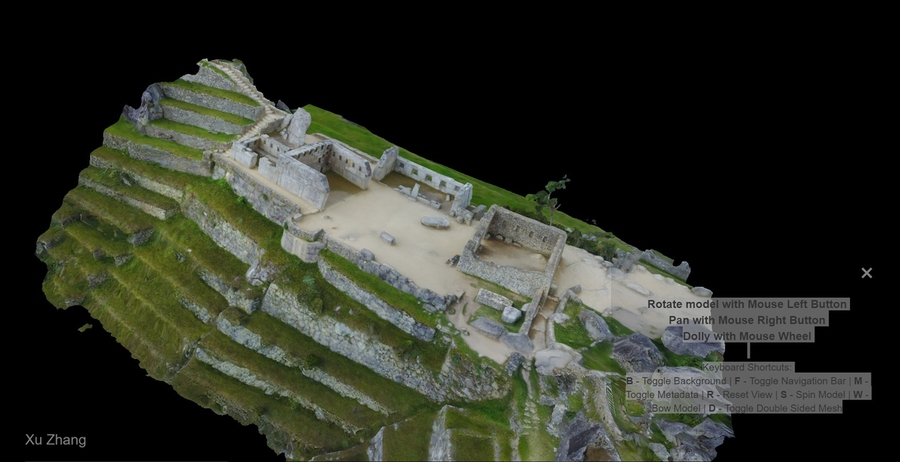
The team, the Architecture Representation and Computation Group, has led the first extensive expedition to digitally document Machu Picchu, using the latest generation of instruments and techniques to explore the site’s architectural and urban importance and develop a 3-D site map using virtual reality and augmented reality. The Architecture Representation and Computation Group has an important record of working with digital capturing technologies on World Heritage Sites in Italy, China, Singapore, and Japan.
"We believe that documentation through computational techniques for the digitalization of architectural monuments is key to the preservation of the cultural heritage of humanity," Nagakura says. “But it is just a simple idea for old practice. From Renaissance time, architects have been going to building sites, and drawing them up to study them. We are just replacing tape measures and Mylar sheets with scanning tools and VR headsets.”
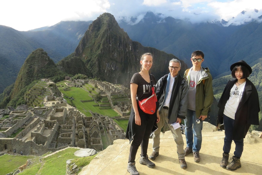
For the project in Peru, the team visited the archaeological complex on two occasions for several weeks in mid-2017 and early 2018. At the site, more than 9,000 images were collected through panoramic cameras, photogrammetric scanning tools, and drones. Gonzalez says the working hours were “intense.”
“We had to reach the archaeological monument before the arrival of the tourists and stay after the closure of the monument," she says. “The great commitment and joint work of the MIT team and the San Antonio Abad del Cusco University, supported by the Decentralized Directorate of Culture of Cusco, made the work fruitful and rewarding.”
Based on the photogrammetric data they sampled, the team developed 3-D models and are working on creating virtual reality experiences that would allow people to immerse themselves in Machu Picchu from anywhere on the planet. The same 3-D models are also being deployed to make a new interactive map of Machu Picchu that superimposes the photographic 3-D view of the site through augmented reality.
Last December, the team launched the MIT Design Heritage Platform, where visitors can see and explore part of the work they have done. In addition, they plan to make this platform a tool to collect images from those who can contribute to the data bank through crowdsourcing.
The project has also managed to document the architectural characteristics and construction materials of the city with high-resolution photographic techniques. The images constitute a unique database with rich information on aspects such as landscape and vegetation at the time the photographs were taken. The team will make all of the information collected available to the authorities of the archaeological monument.
At the same time, they expect that other disciplines can use the databases and photogrammetric models they are developing. The documentation has already been used in conservation efforts, including in the reconstruction of Wiñay Wayna, an archeological site located on the Inca Trail leading to Machu Picchu that was destroyed by a recent flood storm.
Fernando Astete, anthropologist and head of the National Archaeological Park of Machu Picchu, says: "We are very excited with the MIT team work. We welcome all efforts to research and preserve Machu Picchu. We have to protect our heritage for the next generations.”
Architect Cesar Medina, responsible for the digitization of the national park, believes that the collaboration with MIT has been enriching.
“We have been working in 3-D documentation since 2013, but the collaboration with the MIT team lead by Professor Nagakura, with the support of our local university, has allowed us to exhaustively document Machu Picchu, making use of the latest technologies and innovative techniques,” Medina says. “Moreover, we have had the opportunity to visit and know the work of his lab; we see with great interest to continue working in the future with MIT.”
The Architecture Representation and Computation Group is already in conversation with institutions of higher education and heritage conservation of Peru to continue advancing the project of digital inheritance. In addition to continuing in Machu Picchu, they may extend the documentation areas to other archaeological sites of Peru. The project has also opened the doors to possible interdisciplinary collaborations with materials science researchers, urban planners, hydrologist, engineers, archaeologists, and historians.
The MIT students and research assistants who participated in this project were: Diego Cornejo, Paloma Gonzalez, Takuro Kikuchi, Woong Ki Sung, Chang Liu, Eytan Mann, Wenzhe Peng, Rachelle Villalon, Nikolaos Vlavianos, Xu Zhang.
The Machu Picchu Design Heritage project was made possible thanks to the MISTI Global Seed Funds. MISTI is a part of the Center for International Studies within the School of Humanities, Arts, and Social Sciences (SHASS). The project was also sponsored by the Council of Science, Technology and Technological Innovation of Peru, with the support of the National University of Saint Anthony the Abbot in Cuzco and the Decentralized Directorate of Culture of Cusco.