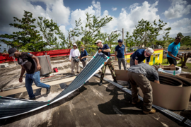
In the wake of a disaster, responding agencies need to assess damage quickly in order to figure out where to focus their efforts and where debris might block rescue crews.
Adam Norige, associate leader of MIT Lincoln Laboratory's Humanitarian Assistance and Disaster Relief Systems Group, says currently these assessments are conducted by “literally driving around or flying a small aircraft and taking digital camera pictures to document the damage.”
But manually monitoring debris is a slow process. So Lincoln Laboratory is undertaking a multidivisional effort to revolutionize this task in disaster response.
“We are trying to show, from a research and development perspective, that we can automate the debris quantification process with Lincoln Laboratory optics and specialized algorithms,” Norige says. By automating the analysis of debris data, laboratory researchers hope to better prepare the Federal Emergency Management Agency (FEMA) for future disasters and reduce the time and cost of planning tasks to repair or clear damages.
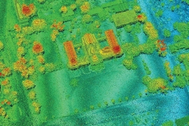
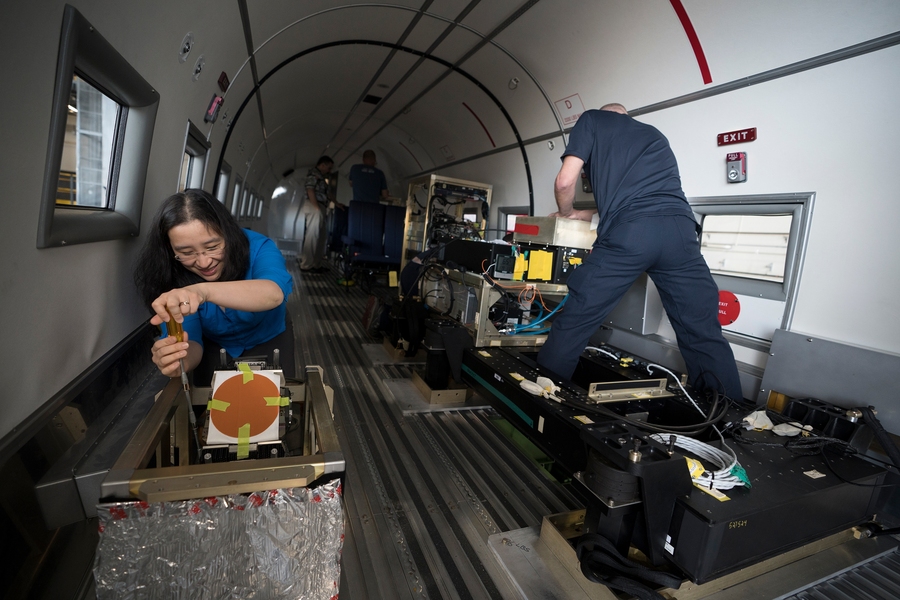
A team in Puerto Rico has used the Airborne Optical Systems Testbed (AOSTB) to develop a baseline lidar map of the entire island, showing the latest topographical conditions and debris resulting from Hurricane Irma and Hurricane Maria in 2017. If another hurricane hits the island in the future, FEMA can track the damage that occurs by comparing subsequent lidar scans to the baseline data.
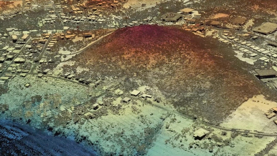
The AOSTB utilizes single-photon-sensitive, time-of-flight imaging technology to collect information about the surface characteristics of the land below. This advanced lidar system, developed by the Active Optical Systems Group, is 10 to 100 times more capable than any commercial system available and can collect wide-area, high-resolution, 3-D datasets very rapidly.
Jalal Khan, leader of the Active Optical Systems Group, says: “Data is great, but what people really want are answers to specific questions … Where can I drive? Where can I position relief supplies? Where can I pitch tents? Where are there downed power lines? Where can I land a helicopter?”
The maps generated by the AOSTB will help FEMA personnel assess damages, quantify debris, inspect infrastructure, and monitor erosion and reconstruction.
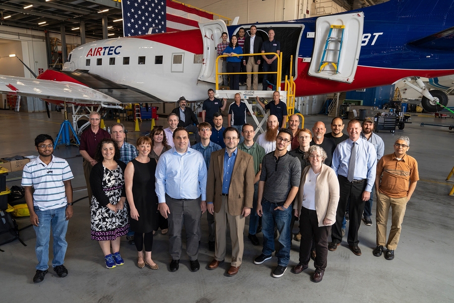
Since the first mission was flown on May 31, laboratory staff, assisted by engineers from 3DEO (a small business located in Massachusetts), have now mapped the entire island of Puerto Rico and the Puerto Rican islands of Vieques and Culebra, crisscrossing over the land during nightly sorties on a BT-67 (a remanufactured and modified DC-3) aircraft. They plan to complete two additional flight campaigns over the next nine months, or as the hurricane season demands.
“One of our goals in this effort was to increase our daily lidar area collection rate,” says John Aldridge, the assistant leader of the Humanitarian Assistance and Disaster Relief Systems Group. “This aircraft is a key enabler, in that it is a long-endurance aircraft capable of eight-hour missions with plenty of space on board for flight crew and support equipment.”
Back on the ground, Anthony Lapadula and Matthew Daggett of the Humanitarian Assistance and Disaster Relief Systems Group led the data management and analysis efforts, while Luke Skelly and Alexandru Vasile of the Active Optical Systems Group led the development of advanced data exploitation algorithms.
Khan says the foundational data collected in Puerto Rico “will form the basis of all analysis and will also be used in the development of automated algorithms that will find points of interests — buildings, roads, powerlines.”
“The map will also form the baseline data against which to compare future maps,” Khan says. “If another hurricane hits, we will be able to see the damage. That is really powerful.”
Since completing the first flight campaign, the team is now working with FEMA to understand how the lidar data can best be translated for operational uses. The FEMA Transportation Sector can immediately use the data to identify sections of roads that were damaged or washed away by Hurricane Maria. Data such as those used to model flood plains are valuable for planning new infrastructure.
Over the next few months, three staff members will be stationed at the FEMA Joint Recovery Office in Puerto Rico to help facilitate this work.
"There are so many questions that can be asked and answered with the data and we are only just now getting started," Aldridge says.
Lincoln Laboratory previously used the AOSTB to assess damage in Houston, Texas, after Hurricane Harvey.
Eventually, Lincoln Laboratory staff plan to add additional sensors to the test bed and make maps of other areas throughout the United States that are susceptible to disasters.
“We hope [the AOSTB] opens the door to all the other sensors that could be used on this platform,” Norige says. “For example, if you used infrared sensors after a disaster, you could find people who are stuck on rooftops or under rubble. There are quite a few modalities we envision coming together on an aircraft.”