In Kenya’s second largest city, Mombasa, the demand for water is expected to double by 2035 to an estimated 300,000 cubic meters per day. In Mombasa’s current warm and humid climate, that water comes from a substantial volume of precipitation that may also change significantly as the region warms in the coming decades in line with global climate model projections.
What’s not clear from the projections, however, is whether precipitation levels will rise or fall along with that warming.
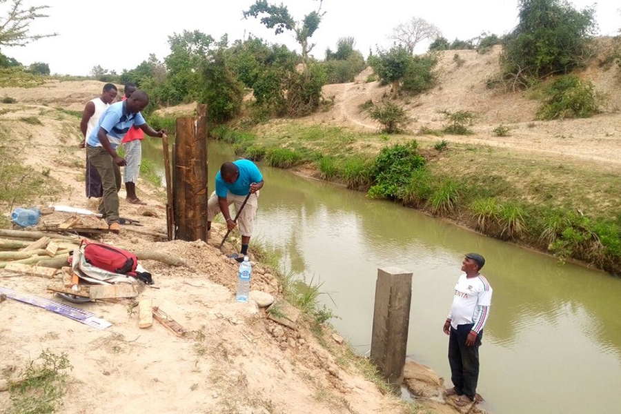
The ultimate direction and magnitude of precipitation change is a major concern for designers of a proposed dam and reservoir system that will capture runoff into the Mwache River, which currently totals about 310,000 cubic meters per day. The substantial uncertainty in future runoff makes it difficult to determine the reservoir capacity necessary to meet Mombasa’s water demand throughout its estimated 100-year lifetime. City planner are therefore faced with deciding whether to invest in an expensive, large-scale dam to provide a consistent water supply under the driest future climate projected by the models, a smaller-scale dam that could accommodate current needs, or start small and build capacity as needed.
To help cities like Mombasa sort through such consequential decisions, a team of researchers at the MIT Joint Program on the Science and Policy of Global Change has developed a new, systematic approach to designing long-term water infrastructure amid climate change uncertainty. Their planning framework assesses the potential to learn about regional climate change over time as new observations become available, and thus evaluate the suitability of flexible approaches that add water storage capacity incrementally if the climate becomes warmer and drier.
The researchers describe the framework and its application to Mombasa in the journal Nature Communications.
A new framework for water infrastructure design
Using the framework to compare the likely lifetime costs of a flexible approach with those of two static, irreversible options for the proposed dam in Mombasa — one designed for the driest, warmest climate, the other for today’s climate — the research team found the flexible approach to be the most cost-effective while still maintaining a reliable supply of water to Mombasa.
“We found that the flexible adaptive option, which allows for the dam’s height to be increased incrementally, substantially reduces the risk of overbuilding infrastructure that you don’t need, and maintains a similar level of water supply reliability in comparison to having a larger dam from the get-go,” says Sarah Fletcher, the study’s lead author, a postdoctoral fellow at MIT’s Department of Civil and Environmental Engineering.
Fletcher’s work on the study was largely completed as a PhD student at MIT’s Institute for Data, Systems and Society under the supervision of co-author and MIT Joint Program Research Scientist Kenneth Strzepek, and in collaboration with co-author and former Joint Program research associate Megan Lickley, now a PhD student in the Department of Earth, Atmospheric and Planetary Sciences.
The Kenyan government is now in the final stages of the design of the Mwache Dam.
“Due to the Joint Program’s efforts to make leading-edge climate research available for use globally, the results from this study have informed the ongoing design and master planning process,” says Strzepek. “It’s a perfect illustration of the mission of Global MIT: ‘Of the World. In the World. For the World.’”
By pinpointing opportunities to reliably apply flexible rather than static approaches to water infrastructure design, the new planning framework could free up billions of dollars in savings in climate adaptation investments — savings that could be passed on to provide water infrastructure solutions to many more resource-limited communities that face substantial climate risk.
Incorporating learning into large infrastructure decision-making
The study may be the first to address a limitation in current water infrastructure planning, which traditionally assumes that today’s climate change uncertainty estimates will persist throughout the whole planning timeline, one that typically spans multiple decades. In many cases this assumption causes flexible, adaptive planning options to appear less cost-effective than static approaches. By estimating upfront how much planners can expect to learn about climate change in the future, the new framework can enable decision-makers to evaluate whether adaptive approaches are likely to be reliable and cost effective.
"Climate models can provide us with a useful range of potential trajectories of the climate system,” says Lickley. “There is considerable uncertainty in terms of the magnitude and timing of these changes over the next 50 to 100 years. In this work we show how to incorporate learning into these large infrastructure decisions as we gain new knowledge about the climate trajectory over the coming decades."
Using this planning tool, a city planner could determine whether it makes sense to choose a static or flexible design approach for a proposed water infrastructure system based on current projections of maximum temperature and precipitation change over the lifetime of the system, along with information that will eventually come in from future observations of temperature and precipitation change. In the study, the researchers performed this analysis for the proposed Mombasa dam under thousands of future regional climate simulations covering a wide range of potential temperature and precipitation trends.
“For example, if you started off on a high-temperature trajectory and 40 years from now you remain on that trajectory, you would know that none of the low-temperature design options are feasible anymore,” says Fletcher. “At that point you would have exceeded a certain amount of warming, and could then rule out the low-temperature-change planning option, and take advantage of an adaptive approach to increase the capacity.”
Future development on the planning framework may incorporate analysis of the potential to learn about other sources of uncertainty, such as the growth in demand for water resources, during the lifetime of a water infrastructure project.
The study was supported by the MIT Abdul Latif Jameel Water and Food Systems Lab and National Science Foundation.


