Everyday travel within a city — especially commuting — is an important factor influencing the spread of certain diseases in urban settings, according to new research.
The study, co-authored by MIT researchers, uses aggregated mobile phone data to trace the spread of dengue, a mosquito-borne virus, in Singapore during 2013 and 2014. While many studies have linked human travel to the spread of disease over long distances, the current finding is notable for its granularity, tracking the path of contagion over shorter distances and times.
Future research will be needed to determine whether the findings also apply to airborne diseases, such as the flu.
“Human mobility is an important factor in the vector-borne disease epidemics at the urban scales,” says Emanuele Massaro, corresponding author of a new paper outlining the results of the study. The new method, he notes, means that researchers looking at the issue on a city-wide basis “do not need very detailed tracking of individuals that could infringe on privacy, but [can still use] models that capture the key facet of mobility: commuting.”
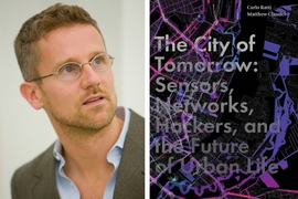
The paper, “Assessing the interplay between human mobility and mosquito borne diseases in urban environments,” appears in Nature Scientific Reports. The authors are Massaro, a scientist with the Laboratory for Human-Environment Relations in Urban Systems (HERUS) at the Swiss Federal Institute of Technology in Lausanne; Daniel Kondor, a postdoc with the Singapore-MIT Alliance for Research and Technology (SMART); and Carlo Ratti, director of the Senseable City Lab at MIT.
To conduct the study, the researchers examined how different models of human movement fit with spread of dengue fever in Singapore during two outbreaks, in 2013 and 2014. Dengue fever is transmitted from mosquitoes to people; there are an estimated 50 million human infections annually around the world, leading to about 500,000 hospitalizations and 25,000 deaths each year.
Given health data about the spread of dengue fever spread in Singpore, the researchers created four models of human mobility in the city-state during this time. The models used data about the estimated number of mosquitoes per human and the mosquito bite rate. The researchers then evaluated which model of mobility corresponded best with the propagation of the illness.
The first model used anonymized call records for 2.3 million people in Singapore from 2011, showing a typical pattern of population movement; the second model, by contrast, assumed random movement; the third model used a common probability distribution to estimate everyday movement of people; and the fourth model used census data showing home locations, then applied a paradigm of urban movement previously developed by scholars (a “radiation model”) to estimate travel in Singapore. The researchers then ran a series of simulations for each model.
Given the numbers of mosquitoes and the infection rates, the scholars found that two of these four models — the one using mobile phone data, and the “radiation” model — performed the best, consistently approximating the spatial distribution of dengue cases that had occurred, over time, during the outbreaks.
The researchers adopted a metric used in image processing to quantify the difference between the simulated snapshots of infected cases and the real results; a model would score 1 if the two maps of infections were the same, and 0 if they had nothing in common. The models and real outcomes were compared on a weekly basis. Averaged over time, the two best models each scored just below 0.8; the model with the probability distribution of movement scored just under 0.7; and the model with random movement performed worst, under 0.6.
Those findings reinforcing the significance of everyday mobility — especially ordinary home-work commuting — to the spread of the illness. About 80 percent of working residents, the researchers estimate, live and work in different areas of Singapore.
Given knowledge of outbreak locations and these commuting patterns, the findings suggest some useful applications for public officials, the researchers believe.
“Authorities would be able to identify which urban areas have a higher risk of contagion,” Kondor says, adding that officials could craft policies that range from “focusing the resources spent on mosquito population control, to informing citizens so that they can be more alert [to aid] prevention.”
To be clear, dengue fever comes from mosquitoes themselves, and is not transmitted face-to-face among people. The higher risk of contagion, therefore, could occur due to more people entering into mosquito-infested areas, for example during their work commutes.
Ratti says it is “crucial” to note this distinction. Because “disease transmission is not dependent on face-to-face contact between people, but [their] subsequent stays in the same area,” the effects of commuting in this case presumably differ from those that would be observed for airborne diseases such as the flu.
“We expect that spread of such diseases [like the flu] will have a different pattern, and it is an interesting question to what extent the current results apply there,” Ratti says, noting that future studies could explore this point with similar levels of detail.
In either case, Ratti observes, “such research is sorely needed, in light of the increasing pandemic warnings by the World Health Organization and last month’s publication of the Global Health Security Index … which shows that many countries have weaknesses in their ability to prevent, detect, and respond to disease outbreaks.”
Massaro believes this kind of research could prove “especially important in developing countries,” and says the current study can be extended into a further examine of the precise options officials would have available to them, in case of future outbreaks.
“In the next steps we would aim at developing models and data-driven monitoring systems to detect [the] safest commuting urban pathways,” he says.
The study was funded, in part, by the HERUS Lab at the Ecole Polytechnique Federale de Lausanne, the Swiss Mobiliar company, the ENAC Exploratory Grant 2018, the Habitat Research Center at the Ecole Polytechnique Federale de Lausanne, and also aided by the MIT Senseable City Laboratory.


