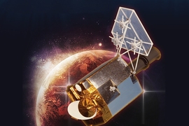
According to Space-Track.org, approximately 21,000 objects of human origin are orbiting Earth, and about 1,500 of these objects are in or near geosynchronous orbit (GEO). Satellites in GEO support critical services, including commercial and military communications, weather forecasting, and missile launch warnings. The number of satellites and debris objects in the GEO belt is growing as launch rates increase and more countries gain access to space. These sensors will support the comprehensive space domain awareness (SDA) tracking efforts that provide for warning of impending collisions.
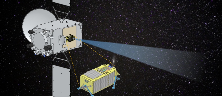
Over the past 30 years, the United States has developed an extensive network of optical and radar sensors that provide observations to enable SDA. As other countries build up their SDA capabilities, sharing SDA data could be a cost-effective way for nations to broaden coverage of the space environment. An example of such data sharing is a current collaboration between the United States and Japan. Because the United States and Japan have similar interests in space security, particularly for space assets over the western Pacific, a partnership arose under a program called SĀCHI (Situational Awareness Camera Hosted Instrument), in which the United States would provide sensors to be hosted on board regional navigation satellites that Japan is developing. These satellites will join an existing constellation, the Quasi-Zenith Satellite System (QZSS), which works with the U.S. global positioning satellite constellation to enhance navigation and timing services for users in Japan and the western Pacific.
MIT Lincoln Laboratory became involved with the U.S.-Japanese partnership in 2019 after the U.S. Air Force approached the laboratory with the concept of developing two identical SDA payloads that would be hosted on separate Japanese satellites. The laboratory is working with the Japanese National Space Policy Secretariat and Mitsubishi Electric Company to integrate state-of-the-art sensors on the newest satellites in the QZSS constellation, QZS-6 and QZS-7, which are scheduled for launch in 2023 and 2024, respectively. The observations of objects in GEO from the SĀCHI sensors will be relayed via secure link for inclusion in the existing U.S. SDA database maintained at Schriever Air Force Base in Colorado. Observations will be made available to Japan via data-sharing agreements.
"This program will allow the United States to monitor satellite behavior within the GEO belt over a very interesting part of the world. The data collected by these platforms will be utilized operationally by the National Space Defense Center and National Air and Space Intelligence Center, and will also be used to further develop and support several ongoing data processing and analytics efforts at the laboratory," says Mark Huber, a technical staff member in Lincoln Laboratory's Space Systems and Technology Division. "It is also a pathfinder in several ways. The U.S. team is blueprinting methods to allow sensitive data sharing between the United States and Japan," he adds.
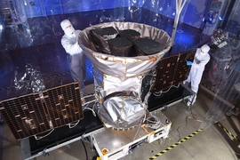
The Space Systems and Technology Division was engaged to lead this program because of its extensive experience in SDA sensor development and, in particular, its development of the ORS-5/SensorSat satellite, currently operating in low Earth orbit (LEO). SensorSat, launched into LEO in 2017, monitors space activity in the GEO belt, roughly 35,800 kilometers above Earth. This small satellite takes advantage of a unique viewing geometry to allow for high-sensitivity collections from a small optical aperture, thus reducing the cost of the satellite considerably when compared with other approaches.
"This project [with Japan] takes our SensorSat technology out to the GEO belt to provide a different dataset to augment SensorSat's mission," says Linda Fuhrman of the laboratory's Engineering Division, which is participating in the build of the payloads.
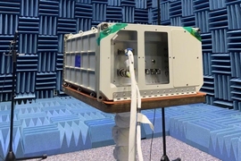
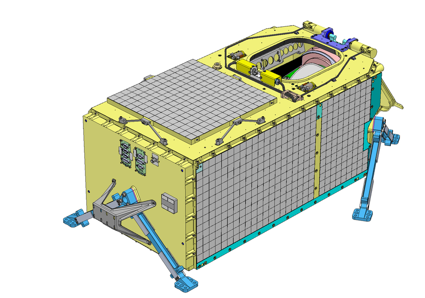
While the SĀCHI program heavily leverages the SensorSat development, there are some very important differences. The SĀCHI payload is simpler than a fully autonomous satellite in that it does not need to generate its own power (e.g., solar cells, battery) and also does not require guidance, navigation, and control capability. However, the payload must withstand a much harsher radiation environment in GEO orbit than SensorSat faces in LEO.
Another difference is that the SĀCHI payloads will rely upon the Japan radio-frequency (RF) communication link to the ground. "Japan is only able to allot 2 kilobits per second for downlink for the payload, whereas SensorSat utilizes 7.5 megabits per second through a dedicated link to the Air Force Space Control Network of ground receivers. Therefore, a significantly different approach is required for getting mission data to the ground," says Mark Bury, program manager for the SĀCHI development. "A significant amount of the processing of the images will have to be performed onboard the payload, sending target tracks and observations to the ground," he explains. In contrast, SensorSat sends raw compressed images to the ground station for processing.
Finally, SensorSat performs its autonomous search mission inherently as this LEO satellite rotates around the Earth, viewing the GEO belt once every 100 minutes. Because of the Japanese satellites' collocation within the GEO belt, they would have a very narrow view of other satellites in the belt. To enable a larger overall field of regard, a two-axis scan mirror was added to the design to improve mission utility with the same basic system from the SensorSat program.
The SĀCHI program was tasked with providing the payloads in 2022. Similar to SensorSat, SĀCHI has a rapid development timeline, made more challenging because of the additional complexity of collaborating with a foreign partner for the interface development, planning, and ultimate integration and launch of the payloads. Lincoln Laboratory completed critical design reviews of the payload with the Air Force in mid-2020. During late 2020, the laboratory team will focus on building and testing the engineering development units, and in 2021, the flight units will undergo build and test.
"While it is a challenge to design, build, and test the SĀCHI payload on a rapid development schedule, we envision that the new onboard processing capability will be a unique enabling technology that can be leveraged for future space domain awareness systems," says Bury.