Network analysis — the mathematical analysis of relationships between elements or actors in a complex system — has become popular among transportation planners and spatial analysts, but its use remains relatively limited among architects and urban designers, whose day-to-day work demands more visioning than analysis.
Now, researchers at the joint MIT-SUTD International Design Center (IDC) have created a free network analysis plugin for Rhinoceros 3-D modeling software, one of the most popular software platforms among architects and urban designers. The new Urban Network Analysis (UNA) plugin enables urban planners and architects to describe spatial patterns of cities using mathematical network analysis methods.
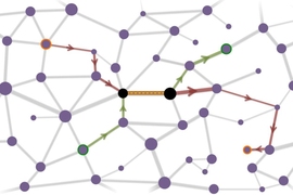
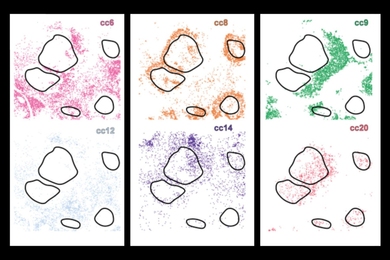
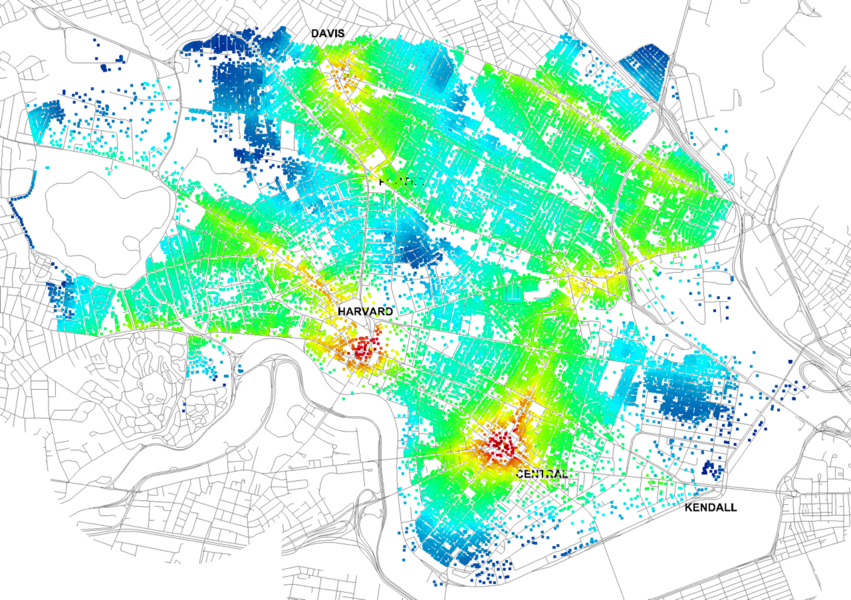
“Every built environment contains a spatial order, marked by relationships of proximity and adjacency between different buildings, public spaces, and routes that connect them,” explains Andres Sevtsuk, the principal investigator of the City Form Lab at IDC that produced the plugin. “Our toolbox helps planners and architects analyze these relationships and quantify how intensely different routes are likely to be utilized, how visible or connected public spaces are, or how conveniently one can get from one space to another. This, in turn, helps them understand what locations in the city are better or worse for particular land uses, how many and what types of users public space are likely to benefit, or how the activities in one location might influence another.”
The free plugin-in offers tools for modeling pedestrian flow along networks, locating facilities at optimal places, measuring spatial accessibility between numerous origins and destinations, and detecting alternative travel routes, along both 2-D and 3-D networks. Users can flexibly create new networks based on proposed designs or edit existing networks, making iterative evaluation simple and intuitive. The use of numeric weights enables users to characterize different origin and destination locations according to their real-world measurable qualities, allowing the analyses to be customized for a wide variety of context-specific applications.
“For example, users can evaluate the accessibility of different spaces in their urban design proposal in relation to the actual circulation networks in the broader urban context, predict where most foot-traffic is going to occur, and calibrate the locations of entrances or amenities accordingly,” says Raul Kalvo, a researcher on the project.
The incorporation of these powerful network analysis tools into Rhinoceros 3-D makes network analysis functions available within a few clicks in any urban design project, according to John E. Fernández, the International Design Center’s co-director.
"Having UNA metrics within the Rhinoceros 3-D software environment not only allows one to analyze how a specific spatial network performs, but also to incorporate the analysis into a fast and iterative design process, where networks can be designed, evaluated, and redesigned in seamless cycles to rapidly improve design outcomes,” says John Fernandez, who is also a professor of architecture at MIT and director of the MIT Building Technology Program.
The UNA toolbox can be downloaded from the City Form Lab website.