Nearly 10 years after Los Angeles was shaken by the devastating, magnitude 6.7 Northridge earthquake, scientists at NASA, MIT and other institutions show that maturing space-based technologies, new ground-based techniques and more complex computer models are rapidly advancing our understanding of earthquakes and earthquake processes.
The past decade has seen substantial progress in space-based earthquake research. "We've confirmed through space observation the Earth's surface is constantly moving, periodically resulting in earthquakes, and we can measure both the seismically quiet motions before and after earthquakes, as well as the earthquakes themselves," said Andrea Donnellan, a geophysicist at NASA's Jet Propulsion Laboratory. "These technologies are allowing us to pursue lines of data and research we didn't know existed only a few years ago."
Two months before the Northridge earthquake, Donnellan and university colleagues, including Bradford H. Hager, professor of Earth, Atmospheric and Planetary Sciences at MIT, published a paper in the journal Nature on ground deformation north of Los Angeles' San Fernando Valley. Six years of Global Positioning System (GPS) data showed the area's faults were active and building up strain, and indicated the size and style of a potential earthquake there. Following the earthquake, the data made it possible to rapidly determine where the fault ruptured and to measure how the earthquake had deformed the Earth's surface.
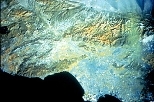
Space-based instruments can image Earth movements to within fractions of an inch, measuring the slow buildup of deformation along faults, and mapping ground deformation after an earthquake. Two primary tools are the space-based GPS navigation system and Interferometric Synthetic Aperture Radar (InSAR). The latter compares satellite radar images of Earth taken at different times to detect ground movement.
InSAR complements surface measurements because it lets us look at whole regions in a spatial context. An InSAR mission is also a key component of EarthScope, an initiative led jointly by the National Science Foundation (NSF), NASA and the U.S. Geological Survey (USGS). EarthScope studies the North American continent's structure and evolution, and the physical processes that control earthquakes and volcanic eruptions.
Precise Earth surface-movement data measure strain, and provide a first approximation of where earthquakes are likely to occur, notes Hager, co-author of the 1993 Nature paper. "In California, patterns of ground deformation are complicated by the complex interactions between fault systems," he says. "Interpreting this data requires computer models that can estimate how much deformation has accumulated and identify regions where strain should be released, but hasn't been."
NASA's QuakeSim project is developing a similar forecasting methodology. Its tools simulate earthquake processes, and manage and model the increasing quantities of data available.
A NASA/Department of Energy-funded research team reports promising results from an experiment to forecast earthquakes in southern/central California from 2000 to 2010. It uses mathematical methods to forecast likely locations of earthquakes above magnitude 5 by processing data on earthquakes of about magnitude 3 from the past decade.
A version of this article appeared in MIT Tech Talk on December 17, 2003.