Device offers long-distance, low-power underwater communication
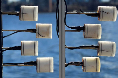
The system could be used for battery-free underwater communication across kilometer-scale distances, to aid monitoring of climate and coastal change.
The system could be used for battery-free underwater communication across kilometer-scale distances, to aid monitoring of climate and coastal change.
Professor of urban and environmental planning David Hsu explains what municipal governments are doing as climate change accelerates.
“Natural collaborator and advocate for students” will oversee the educational experience of the Institute’s 7,000 graduate students.
The senior staff accountant, who discovered a passion for finance while at MIT, says Boston reminds her of the Nigerian city where she grew up — minus the weather.
The master’s student and co-founder of the Sunrise Movement works toward embedding climate into every level of government.
Mens, Manus and Machina (M3S) will design technology, training programs, and institutions for successful human-machine collaboration.
“The Laboratory of Change” is the theme for the 18th International Architecture Exhibition.

TeleAbsence, a project from the MIT Media Lab, probes and imitates the way humans process feelings of belonging, love, and loss.

MIT Sloan Professor Andy Sun works to improve the electricity grid so it can better use renewable energy.
The longtime senior administrative assistant reflects on some of her proudest moments at MIT.
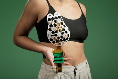
The new device, which can be incorporated into a bra, could allow more frequent monitoring of patients at high risk for breast cancer.
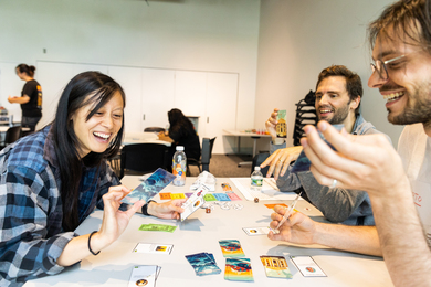
MIT board game designers take on social and cultural topics, with a playful twist.
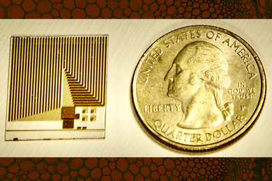
The device detects the same molecules that cell receptors do, and may enable routine early screening for cancers and other diseases.
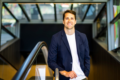
PhD student Nick Caros develops tools to help transit agencies serve the public in an era of remote work.
Less expensive than refrigerated cold rooms, this cooling chamber offers accessible cold storage for smallholder farmers.