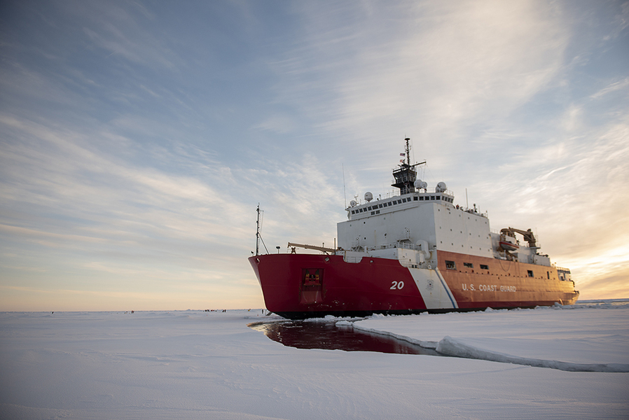
As the U.S. Coast Guard (USCG) icebreaker Healy takes part in a voyage across the North Pole this summer, it is capturing images of the Arctic to further the study of this rapidly changing region. Lincoln Laboratory researchers installed a camera system aboard the Healy while at port in Seattle before it embarked on a three-month science mission on July 11. The resulting dataset, which will be one of the first of its kind, will be used to develop artificial intelligence tools that can analyze Arctic imagery.
"This dataset not only can help mariners navigate more safely and operate more efficiently, but also help protect our nation by providing critical maritime domain awareness and an improved understanding of how AI analysis can be brought to bear in this challenging and unique environment," says Jo Kurucar, a researcher in Lincoln Laboratory's AI Software Architectures and Algorithms Group, which led this project.
As the planet warms and sea ice melts, Arctic passages are opening up to more traffic, both to military vessels and ships conducting illegal fishing. These movements may pose national security challenges to the United States. The opening Arctic also leaves questions about how its climate, wildlife, and geography are changing.
Today, very few imagery datasets of the Arctic exist to study these changes. Overhead images from satellites or aircraft can only provide limited information about the environment. An outward-looking camera attached to a ship can capture more details of the setting and different angles of objects, such as other ships, in the scene. These types of images can then be used to train AI computer-vision tools, which can help the USCG plan naval missions and automate analysis. According to Kurucar, USCG assets in the Arctic are spread thin and can benefit greatly from AI tools, which can act as a force multiplier.
The Healy is the USCG's largest and most technologically advanced icebreaker. Given its current mission, it was a fitting candidate to be equipped with a new sensor to gather this dataset. The laboratory research team collaborated with the USCG Research and Development Center to determine the sensor requirements. Together, they developed the Cold Region Imaging and Surveillance Platform (CRISP).
"Lincoln Laboratory has an excellent relationship with the Coast Guard, especially with the Research and Development Center. Over a decade, we’ve established ties that enabled the deployment of the CRISP system," says Amna Greaves, the CRISP project lead and an assistant leader in the AI Software Architectures and Algorithms Group. "We have strong ties not only because of the USCG veterans working at the laboratory and in our group, but also because our technology missions are complementary. Today it was deploying infrared sensing in the Arctic; tomorrow it could be operating quadruped robot dogs on a fast-response cutter."
The CRISP system comprises a long-wave infrared camera, manufactured by Teledyne FLIR (for forward-looking infrared), that is designed for harsh maritime environments. The camera can stabilize itself during rough seas and image in complete darkness, fog, and glare. It is paired with a GPS-enabled time-synchronized clock and a network video recorder to record both video and still imagery along with GPS-positional data.
The camera is mounted at the front of the ship's fly bridge, and the electronics are housed in a ruggedized rack on the bridge. The system can be operated manually from the bridge or be placed into an autonomous surveillance mode, in which it slowly pans back and forth, recording 15 minutes of video every three hours and a still image once every 15 seconds.
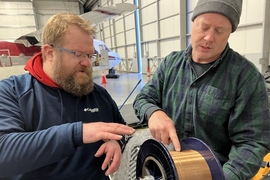
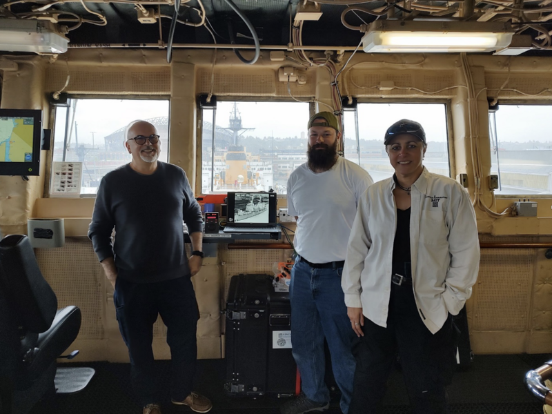
"The installation of the equipment was a unique and fun experience. As with any good project, our expectations going into the install did not meet reality," says Michael Emily, the project's IT systems administrator who traveled to Seattle for the install. Working with the ship's crew, the laboratory team had to quickly adjust their route for running cables from the camera to the observation station after they discovered that the expected access points weren't in fact accessible. "We had 100-foot cables made for this project just in case of this type of scenario, which was a good thing because we only had a few inches to spare," Emily says.
The CRISP project team plans to publicly release the dataset, anticipated to be about 4 terabytes in size, once the USCG science mission concludes in the fall.
The goal in releasing the dataset is to enable the wider research community to develop better tools for those operating in the Arctic, especially as this region becomes more navigable. "Collecting and publishing the data allows for faster and greater progress than what we could accomplish on our own," Kurucar adds. "It also enables the laboratory to engage in more advanced AI applications while others make more incremental advances using the dataset."
On top of providing the dataset, the laboratory team plans to provide a baseline object-detection model, from which others can make progress on their own models. More advanced AI applications planned for development are classifiers for specific objects in the scene and the ability to identify and track objects across images.
Beyond assisting with USCG missions, this project could create an influential dataset for researchers looking to apply AI to data from the Arctic to help combat climate change, says Paul Metzger, who leads the AI Software Architectures and Algorithms Group.
Metzger adds that the group was honored to be a part of this project and is excited to see the advances that come from applying AI to novel challenges facing the United States: “I’m extremely proud of how our group applies AI to the highest-priority challenges in our nation, from predicting outbreaks of Covid-19 and assisting the U.S. European Command in their support of Ukraine to now employing AI in the Arctic for maritime awareness."
Once the dataset is available, it will be free to download on the Lincoln Laboratory dataset website.