tktkt
Traffic vs. Tech in the 1960s: how a highway could have split the Institute's campus
Publication Date:
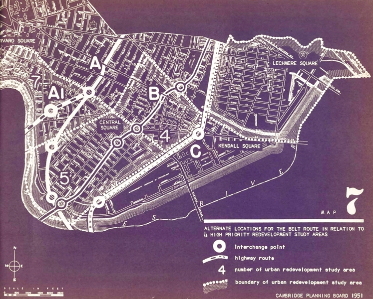
Caption:
This 1951 map shows a proposed highway cutting through MIT.
Credits:
Image courtesy of the MIT archives