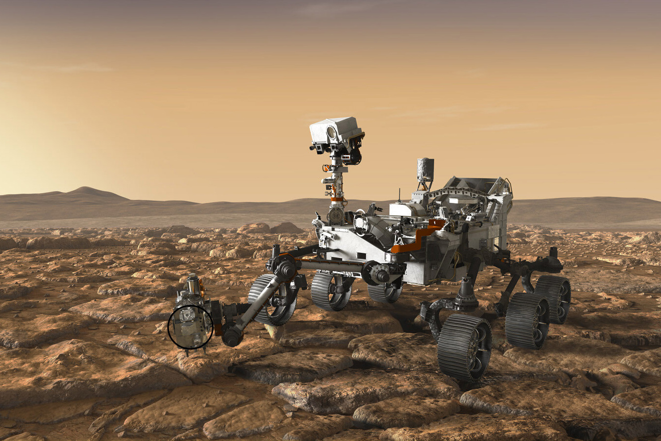


As it trundles around an ancient lakebed on Mars, NASA’s Perseverance rover is assembling a one-of-a-kind rock collection. The car-sized explorer is methodically drilling into the Red Planet’s surface and pulling out cores of bedrock that it’s storing in sturdy titanium tubes. Scientists hope to one day return the tubes to Earth and analyze their contents for traces of embedded microbial life.
Since it touched down on the surface of Mars in 2021, the rover has filled 20 of its 43 tubes with cores of bedrock. Now, MIT geologists have remotely determined a crucial property of the rocks collected to date, which will help scientists answer key questions about the planet’s past.
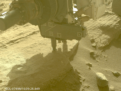
Image: NASA/JPL-Caltech/ASU/MSSS
In a study appearing today in the journal Earth and Space Science, an MIT team reports that they have determined the original orientation of most bedrock samples collected by the rover to date. By using the rover’s own engineering data, such as the positioning of the vehicle and its drill, the scientists could estimate the orientation of each sample of bedrock before it was drilled out from the Martian ground.
The results represent the first time scientists have oriented samples of bedrock on another planet. The team’s method can be applied to future samples that the rover collects as it expands its exploration outside the ancient basin. Piecing together the orientations of multiple rocks at various locations can then give scientists clues to the conditions on Mars in which the rocks originally formed.
“There are so many science questions that rely on being able to know the orientation of the samples we’re bringing back from Mars,” says study author Elias Mansbach, a graduate student in MIT’s Department of Earth, Atmospheric and Planetary Sciences.
“The orientation of rocks can tell you something about any magnetic field that may have existed on the planet,” adds Benjamin Weiss, professor of planetary sciences at MIT. “You can also study how water and lava flowed on the planet, the direction of the ancient wind, and tectonic processes, like what was uplifted and what sunk. So it’s a dream to be able to orient bedrock on another planet, because it’s going to open up so many scientific investigations.”
Weiss and Mansbach’s co-authors are Tanja Bosak and Jennifer Fentress at MIT, along with collaborators at multiple institutions including the Jet Propulsion Laboratory at Caltech.
Profound shift
The Perseverance rover, nicknamed “Percy,” is exploring the floor of Jezero Crater, a large impact crater layered with igneous rocks, which may have been deposited from past volcanic eruptions, as well as sedimentary rocks that likely formed from long-dried-out rivers that fed into the basin.
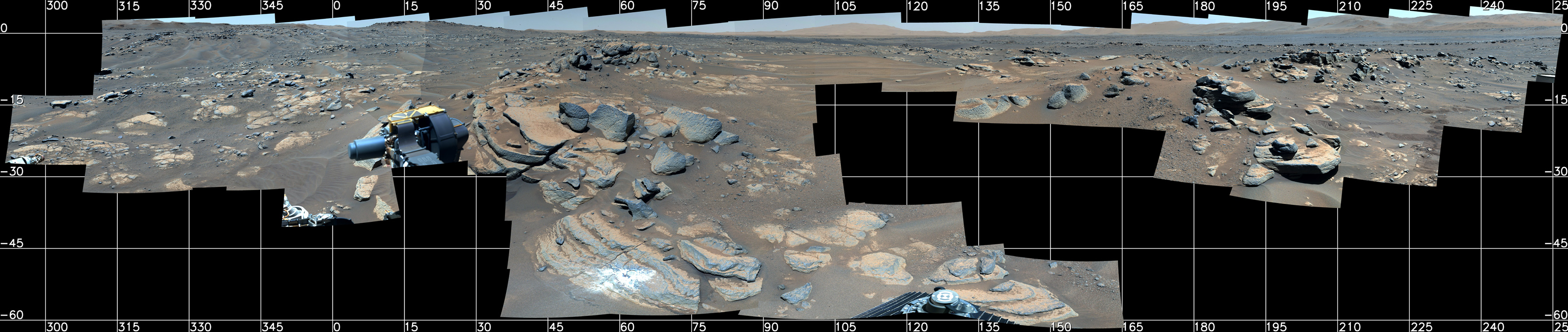
Image: NASA/JPL-Caltech/ASU/MSSS
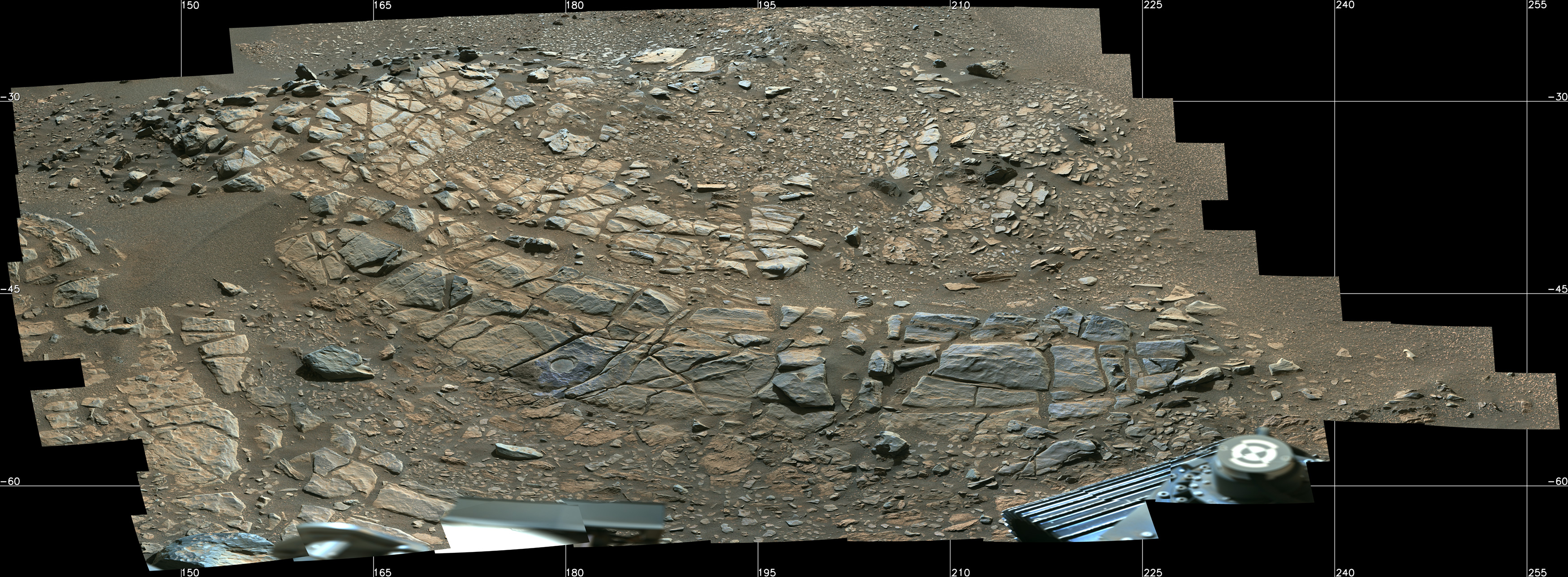
Image: NASA/JPL-Caltech/ASU/MSSS
“Mars was once warm and wet, and there’s a possibility there was life there at one time,” Weiss says. “It’s now cold and dry, and something profound must have happened on the planet.”
Many scientists, including Weiss, suspect that Mars, like Earth, once harbored a magnetic field that shielded the planet from the sun’s solar wind. Conditions then may have been favorable for water and life, at least for a time.
“Once that magnetic field went away, the sun’s solar wind — this plasma that boils off the sun and moves faster than the speed of sound — just slammed into Mars’ atmosphere and may have removed it over billions of years,” Weiss says. “We want to know what happened, and why.”
The rocks beneath the Martian surface likely hold a record of the planet’s ancient magnetic field. When rocks first form on a planet’s surface, the direction of their magnetic minerals is set by the surrounding magnetic field. The orientation of rocks can thus help to retrace the direction and intensity of the planet’s magnetic field and how it changed over time.
Since the Perseverance rover was collecting samples of bedrock, along with surface soil and air, as part of its exploratory mission, Weiss, who is a member of the rover’s science team, and Mansbach looked for ways to determine the original orientation of the rover’s bedrock samples as a first step toward reconstructing Mars’ magnetic history.
“It was an amazing opportunity, but initially there was no mission requirement to orient bedrock,” Mansbach notes.
Roll with it
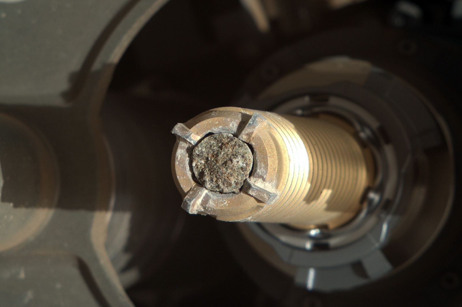
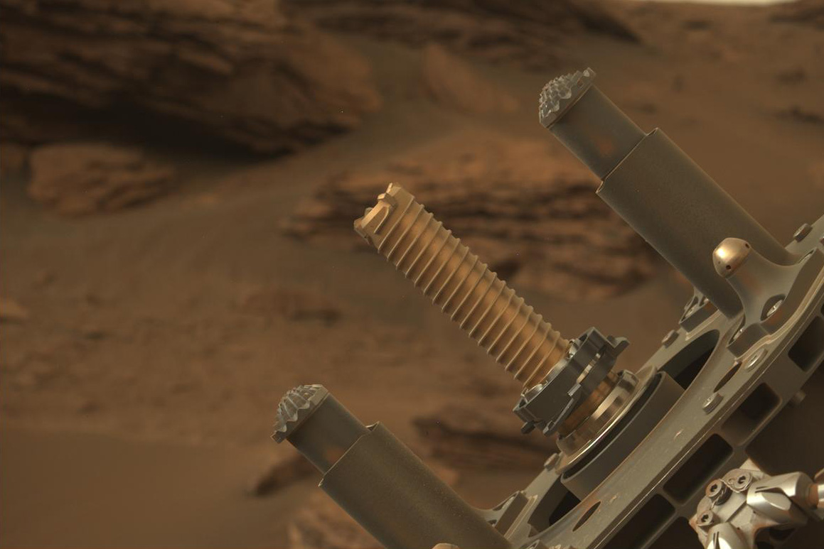
Over several months, Mansbach and Weiss met with NASA engineers to hash out a plan for how to estimate the original orientation of each sample of bedrock before it was drilled out of the ground. The problem was a bit like predicting what direction a small circle of sheetcake is pointing, before twisting a round cookie cutter in to pull out a piece. Similarly, to sample bedrock, Perseverance corkscrews a tube-shaped drill into the ground at a perpendicular angle, then pulls the drill directly back out, along with any rock that it penetrates.
To estimate the orientation of the rock before it was drilled out of the ground, the team realized they need to measure three angles, the hade, azimuth, and roll, which are similar to the pitch, yaw, and roll of a boat. The hade is essentially the tilt of the sample, while the azimuth is the absolute direction the sample is pointing relative to true north. The roll refers to how much a sample must turn before returning to its original position.
In talking with engineers at NASA, the MIT geologists found that the three angles they required were related to measurements that the rover takes on its own in the course of its normal operations. They realized that to estimate a sample’s hade and azimuth they could use the rover’s measurements of the drill’s orientation, as they could assume the tilt of the drill is parallel to any sample that it extracts.
To estimate a sample’s roll, the team took advantage of one of the rover’s onboard cameras, which snaps an image of the surface where the drill is about to sample. They reasoned that they could use any distinguishing features on the surface image to determine how much the sample would have to turn in order to return to its original orientation.
In cases where the surface bore no distinguishing features, the team used the rover’s onboard laser to make a mark in the rock, in the shape of the letter “L,” before drilling out a sample — a move that was jokingly referred to at the time as the first graffiti on another planet.
By combining all the rover’s positioning, orienting, and imaging data, the team estimated the original orientations of all 20 of the Martian bedrock samples collected so far, with a precision that is comparable to orienting rocks on Earth.
“We know the orientations to within 2.7 degrees uncertainty, which is better than what we can do with rocks in the Earth,” Mansbach says. “We’re working with engineers now to automate this orienting process so that it can be done with other samples in the future.”
“The next phase will be the most exciting,” Weiss says. “The rover will drive outside the crater to get the oldest known rocks on Mars, and it’s an incredible opportunity to be able to orient these rocks, and hopefully uncover a lot of these ancient processes.”
This research was supported, in part, by NASA and the Mars 2020 Participating Scientist program.