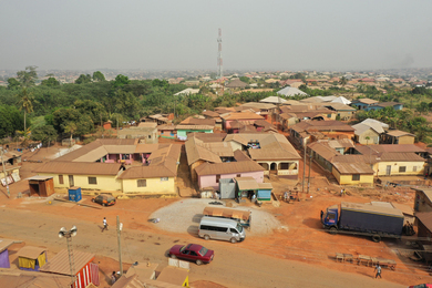
Imagine that you’re a city planner who needs to make decisions about where to place public housing, amenities, or critical services, but you don’t have a complete picture of how people move throughout the city. You simply don’t have the data needed to make these decisions. That is the case for 92 percent of the world’s largest low- and middle-income cities faced with transportation data deficits. Add informal transit into the picture — matatus in Nairobi, colectivos in Mexico City, jeepneys in Manila — and the situation gets even more complex since these modes operate outside of formal public transportation and their routes and schedules tend to be irregular. Not every city has the means of creating or collecting data on informal transit to get that full picture of the network. Sarah Williams is combining her skills as a geographer, architect, data scientist, and city planner to address such deficiencies in developing cities. Her goal is to create data for civic change. Her latest project is an open-platform resource center for Latin American and Caribbean cities.
Q: What is your new initiative and what do you hope to accomplish?
A: We’re creating an open platform for anyone who is interested in accessing tools for mapping urban informal transit in Latin American and Caribbean cities. Transportation data is essential for economic development, and the goal is to make creating and collecting transportation data easier.
Our resource center will link people to the right resources and tools to create transportation data that can influence policy outcomes. We’re linking city transit operators, local governments, nonprofit and civic organizations, startups, and researchers to open access data collection and analysis tools, tutorials, case studies, and a global knowledge network on policy, data, and mobility. Overall, the resource center’s efforts contribute to the United Nations Sustainable Development Goal 11 to “make cities inclusive, safe, resilient and sustainable” and to target 11.2, which calls for “safe, affordable, accessible, and sustainable transport systems for all.”
The MIT Civic Data Design Lab’s main partners for this project are the Inter-American Development Bank and Mastercard Center for Inclusive Growth, and it will be led by World Resources Institute Mexico, the MIT International Policy Lab, and Columbia University’s Earth Institute.
Q: What are the main challenges to collecting urban data in this region and how are you addressing those challenges?
A: When it comes to developing cities, one major challenge is that data is scarce. This is the case across many sectors but especially urban transportation. Another challenge is that governments, NGOs, transit operators, and other actors don’t know how to access funds to pay for data collection, and there is lack of knowledge about the tools that are available for accomplishing this. On top of everything, transportation networks in developing cities are rarely unified. There are hundreds of operators across public transit and informal transit that are not necessarily coordinated with each other in terms of who goes where and who serves whom. This presents challenges to urban planning, reaching sustainable development targets, and providing accessibility to public transit and amenities in cities.
To address these challenges, we coordinate the right stakeholders to be part of transit mapping initiatives, help connect them to funding sources, train people to develop transit data in a standardized format, show people who use transit data as an analysis tool, and connect people to the local tech community to build new products with the transit data.
Q. How did you become interested in urban transportation?
A: I wasn't always interested in transportation, but when I saw how severe congestion in Nairobi could bring the city to a standstill, I knew I needed to get involved and use my skills to address critical transportation problems. I quickly learned how the crippling problems I saw in Nairobi also afflict other developing cities.
The resource center that we’ve launched is largely inspired by the Civic Data Design Lab’s Digital Matatus project in Nairobi. Launched in 2012, Digital Matatus began as a collaboration between MIT, Columbia University, and the University of Nairobi. The project captured transportation data for Nairobi’s informal matatu network and resulted in the development of mobile routing applications and a new transit map for the city. The data, maps and apps are now free and available to the public, transforming the way residents of Nairobi navigate and think about their transportation system.