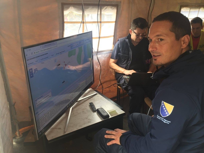
On a Google map of Modrac Lake, located near the city of Tuzla in Bosnia and Herzegovina, icons in the shape of boats move across the water. A commander, looking at the map on a monitor, watches their progress. Each boat in real life holds a disaster response unit that is heading toward the site of a disaster — in this case, a chemical spill. The same interface that provides the map also shows images from the scene, messages between responders, social media posts from observers, and other real-time information that the commander uses to direct people and resources. The interface is one big picture, created and viewed by everyone involved, of the scene as it unfolds.
The platform enabling this coordination is called the Next-Generation Incident Command System (NICS). NICS, developed nearly a decade ago by Lincoln Laboratory and the Department of Homeland Security Science and Technology Directorate (DHS S&T), is used today around the world for emergency response. In its latest development, NICS has been implemented in the southeastern European nations of Bosnia and Herzegovina, Croatia, Macedonia, and Montenegro. Through a four-year partnership with the NATO Science for Peace and Security Programme, Lincoln Laboratory and DHS S&T will work with local and federal response agencies in these countries to adapt and enhance NICS for the specific needs of this multinational community.
“We are working with each country to best decide how NICS can be adapted to meet their disaster-response needs and also how NICS can improve communication across country borders,” says Stephanie Foster, a staff member in the Laboratory’s Humanitarian Assistance and Disaster Relief Systems Group and the program manager for the NICS NATO project. Foster notes that NICS will help the countries build a standardized method of response to large-scale disasters, such as the cyclone and ensuing floods that devastated the region in 2014.
Modifications to NICS are building on what staff learned during the NATO Euro-Atlantic Disaster Response Coordination Centre’s 17th Consequence Management Field Exercise between Sept. 24 and 29 in 2017. Close to 1,300 disaster-response personnel from 34 NATO member and partner nations participated in the exercise.
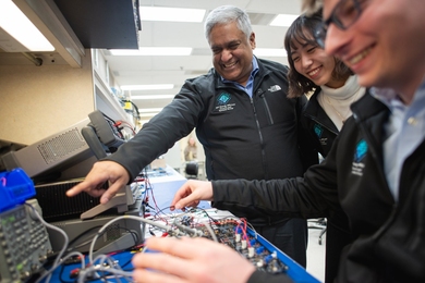
Conveniently hosted in Bosnia and Herzegovina, the exercise provided the southeastern European disaster teams a first road test of the NICS platform. Foster, joined by Laboratory staff members Gregory Hogan, Robert Hallowell, Greg Gianforcaro, and Christopher Budny, traveled to Tuzla to prepare NICS for the exercise. They created a new workspace in NICS where the exercise could be implemented and, importantly, analyzed afterward. They worked with the countries to prepopulate data and geospatial information into the system and to create a standardized communications workflow that teams from each country would follow. They also trained people to use NICS, although the system’s design makes it intuitively easy to use, which is one reason why NICS translates well globally.
For three days, NICS was implemented during water-rescue missions conducted by teams from Montenegro, Bosnia and Herzegovina, and Croatia. The exercise began with an initial emergency request received at the base of operations. From there, teams were deployed to the incident site and given instructions to either lead or assist in different scenarios, such as extracting people from a car that had entered the lake, removing barrels of chemicals and assessing the risk, and saving people from cable cars hanging above the water.
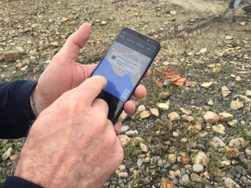
As soon as the emergency was reported, the incident was created in NICS and the information sharing began. At the base camp, commanders logged into the web-based interface using an ordinary web browser and internet connection. The onsite responders logged into NICS through an app on their cell phones. Together, they used NICS to observe the evolving situation and communicate.
“We would get live input from the water-rescue teams that were responding,” Foster says. “They used the mobile app to upload images of the damage and to chat with users at base camp and in the incident command tent.” The NICS mobile app, which is a relatively new addition to the system, also enabled live-tracking of the teams’ locations — resulting in the boat icons moving across the map.
Another new feature of NICS was the incorporation of social media analytics. At the NATO exercise, Douglas Jones, a senior staff member in the Laboratory’s Human Language Technology Group, led a research unit whose goal was to simulate social media activity during a disaster scenario and use the data to help responders gain situational awareness.
“In a real disaster, people would use social media such as Twitter and Facebook to ask for help or give information, but we couldn’t use real social media during the exercise in case someone thought it was real. So, we built a closed system called SIMPOST,” Jones says. A group of local journalism students were trained to post messages in real time to SIMPOST, role playing as either journalists, observers, or victims. By the end of exercise, they had produced a dataset of about 2,000 messages, about half of which were in English and the other half in Bosnian and other languages.
Pulling information from the social media posts is key. The SIMPOST team was supported by a Defense Advanced Research Projects Agency (DARPA) program called LORELEI, a human language technology that aims to provide domain-relevant, essential information from messages written in any language. Using the LORELEI framework, the social media posts from the exercise were categorized by need type (such as medical, water, or search and rescue), urgency level, location, and timeframe.
To get this information out to the responders, the team added layers to the NICS interface that showed posts by need type and a color-coded heat map of social media activity around the incident locations. “We were able to improve this integration while at the exercise to allow the NICS users to search and filter the posts,” says Budny, who built the SIMPOST platform and led its integration into NICS. Users could now choose to see posts by specific need type, and the system could pinpoint on the map where those messages were posted from.
“This integration required collaboration from staff working in different groups in a complex and challenging environment, but look what happened,” Jones says. “We were able to work together to bring a potential new capability to the humanitarian assistance and disaster relief space.”
NICS also offers graphical tools, essentially virtual whiteboards, with which users can draw boundaries or circle locations directly on the map. This feature is especially useful for communicating across language barriers.
NATO is looking for more opportunities to implement NICS internationally. In late September 2017, NATO opened a new center in Kuwait City, called the Istanbul Cooperation Initiative Regional Center, in which NATO researchers can work closely with Persian Gulf partners on a number of important issues, including disaster response. Hogan, senior staff in the Laboratory’s Homeland Protection and Air Traffic Control Division, joined NATO Science for Peace and Security Programme staff at the center to present the NICS capability.
Another long-term goal of the NICS NATO partnership is to engage young scientists and engineers in further developing the NICS technology. The vision is to build an active community with the capability to evolve and contribute to the platform’s open-source software, which DHS S&T released worldwide on GitHub last year.
The next three years will hold much more development for NICS. For the southeastern Europe project, a milestone each year will be a large-scale capability demonstration, like the NATO exercise, that will provide valuable data to learn from. The system archives all aspects of a created incident, so it becomes a powerful tool for analyzing past responses and informing future planning and execution.
“When it’s all over and you can take a step back and analyze the process — that’s when the real work begins,” Foster says.