While many of us, especially those of us trying to feed young children, think of nutrients as desirable, it is possible to have too much of a good thing. Excessive nutrients in an ecosystem disturb the chemical and environmental balance that allows native plants and animals to thrive in harmony.
Marine ecosystems are no exception. When nutrients such as phosphates and nitrogen reach coastal waters — or any body of water — they stimulate algae and other plant growth, choking ocean environments and depriving them of oxygen. Groundwater-derived flows of nitrogen to the coastline are often key contributors to this degradation-by-asphyxiation, a process known as eutrophication.
“It can simply be said that estuarine eutrophication caused by nutrient-laden groundwater is the single most important cause of ecological degradation in most New England coastal waters and especially here on Cape Cod,” says Chris Weidman, research coordinator at the Waquoit Bay National Estuarine Research Reserve (WBNERR) in Falmouth, Mass. “It is by far the major environmental concern of coastal communities and resource managers in Massachusetts.”
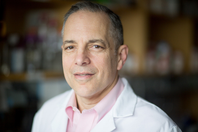
MIT Sea Grant is addressing this concern by providing funding for research that helps managers and residents understand, identify and quantify nutrient pollution along the coast. Matt Charette, a senior scientist in marine chemistry and geochemistry at the Woods Hole Oceanographic Institution (WHOI), received funding from MIT Sea Grant to use new technology to measure nutrients, specifically nitrogen, in coastal surface waters. Through this work, Charette offers a better understanding of the cost of coastal development and the resulting pollution of ocean waters while advancing this field of scientific research.
Nutrient and contaminant pollution flows to the coastal zone from clearly identifiable “point sources” such as sewage pipes, as well as from diffuse, or “non-point sources” such as runoff and submarine groundwater discharge (SGD), the fresh water, and sometimes recirculated seawater, which flows underground from coastal aquifers into the ocean. Everything from atmospheric toxins to agricultural and lawn fertilizers, and pathogens and nutrients from faulty septic systems, can be carried to the ocean by submarine groundwater. En route to the coast, SGD passes through radon-laden sediment and can deliver comparatively high concentrations of radon to surface coastal water, making it a useful indicator of SGD.
Radon detection over coastal waters is step one for Charette in his search for SGD and subsequent testing for nitrogen. Working with Henrieta Dulaiova, a WHOI postdoctoral student at the time of the project, Charette has applied new technology for continuous radon measurements in coastal surface water as a method for quantifying SGD inputs of nitrogen and developed a large scale mapping system that screens for radon as well as nitrate in surface waters along tens of kilometers of coastlines, mapping SGD and nitrogen inputs.
In Waquoit Bay, Charette and Dulaiova identified several areas of high groundwater discharge, and chose two rivers, the Childs and Quashnet, to study in detail. The Childs River was characterized by high nitrate input via groundwater discharge, while the Quashnet River SGD was a measurable but not a significant source of nitrate. “Being able to quantify SGD (as the primary vector of nutrient-loading) and to key in on hot spots of SGD input is a key aspect of the problem,“ Weidman says.
While coastal resource managers at WBNEER have made good use of Charette’s work, it has wider applicability throughout Cape Cod, a region that relies heavily on septic systems for the disposal and processing of household sewage. Septic systems can be significant contributors of nitrogen to groundwater that ultimately reaches the coast, and they are largely unregulated. Local environmental groups have called for increased regulation, and the US Environmental Protection Agency (EPA) is negotiating two federal lawsuits to reduce pollution flowing from septic tanks into Cape Cod waters.
Though unable to comment on the case, Marcel Belaval, a hydrologist at EPA New England (Region 1), comments on Charette’s work and its usefulness to the EPA as it grapples with the prospect of regulating non-point source pollution, such as that from septic systems: “Addressing nitrogen pollution as a water quality concern is a high priority for EPA. Understanding nitrogen transport through groundwater can be an important issue in watersheds where wastewater is disposed of in the subsurface. Research conducted by Matt Charette has helped us better understand the system of nitrogen movement through groundwater and its impacts on coastal ecosystems. Applied research like Matt's is a crucial piece of developing long-term, science-based management strategies to protect coastal resources.”
Charette and his team work hard to ensure that their work gets into the hands of the decision makers who formulate environmental policy and shape coastal management plans. Major interventions in the coastal zone management system, such as groundwater quality management through controls on withdrawal or alterations in recharge patterns, require sound scientific justification and technical understanding. Given that the scale of management areas can be hundreds of kilometers, their work offers a great way to quickly determine the importance of SGD contributions, allowing coastal managers to weigh the relative importance of SGD compared to other factors. Charette’s mapping system will help managers focus on serious challenges rather than wasting valuable time and resources on issues shown by the mapping to be of little import.
Charette’s work also has an important scientific audience, specifically, researchers working with SGD who are in need of high quality tools for measuring and understanding the nature of chemical transformations between the terrestrial and marine systems. Indeed Charette’s work has caught the eye of other researchers in the field. Peter Swarzenski, a senior research oceanographer for the US Geological Survey in Santa Cruz, California, is enthusiastic about Charette’s contribution. He notes, “The coupling of a continuous nitrate sensor to existing submarine groundwater discharge mapping capabilities is a solid advancement that will be very useful for coastal scientists interested in studying transport processes of coastal aquifer as it discharges into the sea. Matt Charette and company are at the forefront of this innovation and we eagerly await initial results and eventual broader applicability.”
This technique is applicable to other coastlines around the world and the technology is easily transferable, at least for the radon measurement. Henrieta Dulaiova, Charette’s co-principal investigator who is now assistant professor at the University of Hawaii in the Department of Geology and Geophysics, says, “In our current studies of the Kona coast, Hawaii and southern Oahu we adapted this technique and it is now a routine part of our field studies."
MIT Sea Grant has a history of funding research related to the degradation of marine ecosystems and the waterways that feed them. Boston University’s Ivan Valiela, who has received MIT Sea Grant funding for four major research projects related to ecological impacts of eutrophication, particularly in Massachusetts estuaries, influenced Charette’s decision to seek out the sources, particularly the submarine sources, of contamination. Charette notes, “The study of SGD took off in the late 1990s when you would find a couple of papers every few years. Today, researchers are producing more than 100 scholarly research papers on this topic annually.”
Having completed the study on radon mapping, and transferred the results to those who can put his findings to work, Charette and his team have won additional research funds from MIT Sea Grant to deliver SGD measurement technology to oceanographers, industry and coastal managers through the development of a low-cost, easy to operate, automated seepage meter. The key innovation in this new meter will be a low power, low cost spectrophotometric sensor for determining groundwater flow based on dye dilution.
Charette is not alone among current MIT Sea Grant researchers engaged with SGD. Among the four MIT Sea Grant projects newly funded in 2012 is Jennifer Bowen’s analysis of the Permeable Reactive Barriers that intercept groundwater flow along beachfront and marsh-edges. Their function is to filter out nitrogen caused by fertilizer runoff, septic waste, and other sources before it causes pollution, eutrophication, algae blooms and other problems along our coasts.
Marine ecosystems are no exception. When nutrients such as phosphates and nitrogen reach coastal waters — or any body of water — they stimulate algae and other plant growth, choking ocean environments and depriving them of oxygen. Groundwater-derived flows of nitrogen to the coastline are often key contributors to this degradation-by-asphyxiation, a process known as eutrophication.
“It can simply be said that estuarine eutrophication caused by nutrient-laden groundwater is the single most important cause of ecological degradation in most New England coastal waters and especially here on Cape Cod,” says Chris Weidman, research coordinator at the Waquoit Bay National Estuarine Research Reserve (WBNERR) in Falmouth, Mass. “It is by far the major environmental concern of coastal communities and resource managers in Massachusetts.”
MIT Sea Grant is addressing this concern by providing funding for research that helps managers and residents understand, identify and quantify nutrient pollution along the coast. Matt Charette, a senior scientist in marine chemistry and geochemistry at the Woods Hole Oceanographic Institution (WHOI), received funding from MIT Sea Grant to use new technology to measure nutrients, specifically nitrogen, in coastal surface waters. Through this work, Charette offers a better understanding of the cost of coastal development and the resulting pollution of ocean waters while advancing this field of scientific research.
Nutrient and contaminant pollution flows to the coastal zone from clearly identifiable “point sources” such as sewage pipes, as well as from diffuse, or “non-point sources” such as runoff and submarine groundwater discharge (SGD), the fresh water, and sometimes recirculated seawater, which flows underground from coastal aquifers into the ocean. Everything from atmospheric toxins to agricultural and lawn fertilizers, and pathogens and nutrients from faulty septic systems, can be carried to the ocean by submarine groundwater. En route to the coast, SGD passes through radon-laden sediment and can deliver comparatively high concentrations of radon to surface coastal water, making it a useful indicator of SGD.
Radon detection over coastal waters is step one for Charette in his search for SGD and subsequent testing for nitrogen. Working with Henrieta Dulaiova, a WHOI postdoctoral student at the time of the project, Charette has applied new technology for continuous radon measurements in coastal surface water as a method for quantifying SGD inputs of nitrogen and developed a large scale mapping system that screens for radon as well as nitrate in surface waters along tens of kilometers of coastlines, mapping SGD and nitrogen inputs.
In Waquoit Bay, Charette and Dulaiova identified several areas of high groundwater discharge, and chose two rivers, the Childs and Quashnet, to study in detail. The Childs River was characterized by high nitrate input via groundwater discharge, while the Quashnet River SGD was a measurable but not a significant source of nitrate. “Being able to quantify SGD (as the primary vector of nutrient-loading) and to key in on hot spots of SGD input is a key aspect of the problem,“ Weidman says.
While coastal resource managers at WBNEER have made good use of Charette’s work, it has wider applicability throughout Cape Cod, a region that relies heavily on septic systems for the disposal and processing of household sewage. Septic systems can be significant contributors of nitrogen to groundwater that ultimately reaches the coast, and they are largely unregulated. Local environmental groups have called for increased regulation, and the US Environmental Protection Agency (EPA) is negotiating two federal lawsuits to reduce pollution flowing from septic tanks into Cape Cod waters.
Though unable to comment on the case, Marcel Belaval, a hydrologist at EPA New England (Region 1), comments on Charette’s work and its usefulness to the EPA as it grapples with the prospect of regulating non-point source pollution, such as that from septic systems: “Addressing nitrogen pollution as a water quality concern is a high priority for EPA. Understanding nitrogen transport through groundwater can be an important issue in watersheds where wastewater is disposed of in the subsurface. Research conducted by Matt Charette has helped us better understand the system of nitrogen movement through groundwater and its impacts on coastal ecosystems. Applied research like Matt's is a crucial piece of developing long-term, science-based management strategies to protect coastal resources.”
Charette and his team work hard to ensure that their work gets into the hands of the decision makers who formulate environmental policy and shape coastal management plans. Major interventions in the coastal zone management system, such as groundwater quality management through controls on withdrawal or alterations in recharge patterns, require sound scientific justification and technical understanding. Given that the scale of management areas can be hundreds of kilometers, their work offers a great way to quickly determine the importance of SGD contributions, allowing coastal managers to weigh the relative importance of SGD compared to other factors. Charette’s mapping system will help managers focus on serious challenges rather than wasting valuable time and resources on issues shown by the mapping to be of little import.
Charette’s work also has an important scientific audience, specifically, researchers working with SGD who are in need of high quality tools for measuring and understanding the nature of chemical transformations between the terrestrial and marine systems. Indeed Charette’s work has caught the eye of other researchers in the field. Peter Swarzenski, a senior research oceanographer for the US Geological Survey in Santa Cruz, California, is enthusiastic about Charette’s contribution. He notes, “The coupling of a continuous nitrate sensor to existing submarine groundwater discharge mapping capabilities is a solid advancement that will be very useful for coastal scientists interested in studying transport processes of coastal aquifer as it discharges into the sea. Matt Charette and company are at the forefront of this innovation and we eagerly await initial results and eventual broader applicability.”
This technique is applicable to other coastlines around the world and the technology is easily transferable, at least for the radon measurement. Henrieta Dulaiova, Charette’s co-principal investigator who is now assistant professor at the University of Hawaii in the Department of Geology and Geophysics, says, “In our current studies of the Kona coast, Hawaii and southern Oahu we adapted this technique and it is now a routine part of our field studies."
MIT Sea Grant has a history of funding research related to the degradation of marine ecosystems and the waterways that feed them. Boston University’s Ivan Valiela, who has received MIT Sea Grant funding for four major research projects related to ecological impacts of eutrophication, particularly in Massachusetts estuaries, influenced Charette’s decision to seek out the sources, particularly the submarine sources, of contamination. Charette notes, “The study of SGD took off in the late 1990s when you would find a couple of papers every few years. Today, researchers are producing more than 100 scholarly research papers on this topic annually.”
Having completed the study on radon mapping, and transferred the results to those who can put his findings to work, Charette and his team have won additional research funds from MIT Sea Grant to deliver SGD measurement technology to oceanographers, industry and coastal managers through the development of a low-cost, easy to operate, automated seepage meter. The key innovation in this new meter will be a low power, low cost spectrophotometric sensor for determining groundwater flow based on dye dilution.
Charette is not alone among current MIT Sea Grant researchers engaged with SGD. Among the four MIT Sea Grant projects newly funded in 2012 is Jennifer Bowen’s analysis of the Permeable Reactive Barriers that intercept groundwater flow along beachfront and marsh-edges. Their function is to filter out nitrogen caused by fertilizer runoff, septic waste, and other sources before it causes pollution, eutrophication, algae blooms and other problems along our coasts.